The muffled drumbeat was insistent on New Year’s Eve morning, the surf sound on the distant barrier island calling me toward the landing. On this daily ritual of going to a place with vistas to the east and south, I turned off on a wooded path and took a brief look at the old Andersonville Road, the original roadway leading from Seewee Road to the former plantation, Andersonville. I continued the walk on unpaved neighborhood roads to that place of a missing mound.
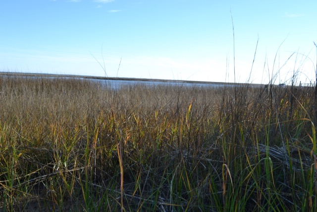
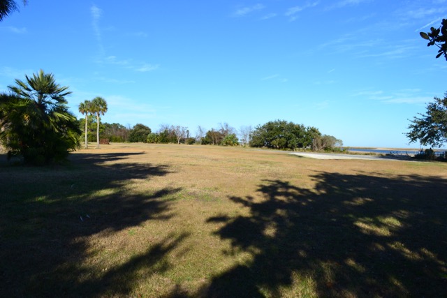
This common property of Romain Retreat has views of the Intracoastal Waterway, the mud flats and marshes of Cape Romain, and Bull Island/Onisecau in the distance. A dock and boat ramp provides neighborhood access to these waters much closer to deep water than elsewhere along this section of the Waterway, where wide swaths of salt marsh separate the land from the channel. This proximity to the Waterway is the result of sand deposition creating a sand spit. On the back side of the common property is an impoundment whose waters spill out of a dike into a brackish marsh that empties into the salt marsh and Waterway at the southwestern tip of this peninsula. When considering a land purchase forty years ago at this new development, Romain Retreat, I was sold on that first viewing of the landing.
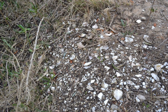
I would only learn years later that this sand spit was the location of what was considered one of the largest shell middens on the South Carolina coast. It was known as the Awendaw Mound, or the Andersonville Mound, 38CH9 as a recorded archaeological site of South Carolina. Small deposits of the shell midden remain on the margins of the narrow southwestern end of the peninsula.
The evidence for the Andersonville Mound is documented in a 1979 article in the journal South Carolina Antiquities. David G. Anderson, and Stephen R. Claggert, “Test Excavations at Two Sites in the Cape Romain National Wildlife Refuge, Charleston County, South Carolina,” South Carolina Antiquities 11, no. 1 (1979): 12-74. (Here is the link to the full Anderson & Claggett article.) The two sites were Moore’s Landing (now renamed Garris Landing), and another on Bull Island that was identified during the project as dredge spoil. There was also a review of other archaeological investigations in the project area including 38CH9. The discussion of the Andersonville Mound is found in Appendix II, and includes various examinations of the site beginning in the 1920’s when Anne King Gregorie, a local historian, went along on a trip with Charleston Museum staff. Gregory made a rough estimate of the shell mound size, and noted an interesting feature on the mound’s top – the brick remains of a Confederate gun base.
The most substantial of those investigations was one recorded in June of 1933 on another Charleston Museum expedition. It was led by G. Robert Lunz and E. Burnham Chamberlain, whose main fields of study were marine biology and vertebrae zoology, respectively. They made detailed maps of the site and shell pile (see maps below). A shell mound 557 feet long, 80 feet wide, and 10 feet 5 inches at its highest point! A flowing artesian well and marsh were noted on the peninsula’s back side. The shell mound also contained soil, and extensive remains of pottery. The indigenous peoples living here probably placed the earth on the mound to make it more livable. There were trees and underbrush growing thickly on the heap, and the authors concluded “that this factor would decidedly increase the cost of excavation.” They also noted that three large areas had been removed for road fill.
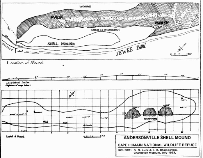
Lunz and Chamberlain only ventured a couple of conclusions as a result of this expedition. The first was quite obvious – the site had been occupied prior to settlers arriving in the area. They did suggest that as many as two hundred families may have gathered there.
The appendix in Anderson and Claggett also reported on a visit to the site by Eugene Waddell, and on other Charleston Museum notes from 1959. At that time the vast majority of the shells had been removed, and the pile was just one foot high at the highest point. The International Paper Company used the shells in building/improving the Andersonville Road for removing pulpwood. In August of 1978 the article author David Anderson made a site visit with two others. The area had been completely leveled by that time, and only in the woods on the edges were there any intact shell deposits. In one hour of surface collection of all decorated, large, or rim sherds, and all lithic objects, they recovered around seventy artifacts.
The Andersonville Mound was initially considered to be part of the Cape Romain study area, but in fact its location was a mile to the northeast of the Garris Landing site. Four miles to the northeast of the Andersonville Mound was the Sewee Shell Ring site. Unlike the Andersonville Mound, the Sewee Shell Ring received several professional archaeological investigations: William Edwards in 1965, and Michael Russo and Gregory Heide in 2003. The 2003 study has provided much information about the site, far more than we know about the Andersonville Mound. Radiocarbon dating for ceramics of the Sewee Shell Ring placed their age at over 3500 years. There is no information about how these two sites were related; they both were two prominent prehistoric places accommodating many people.
The Andersonville Mound was treated as a resource to be exploited similar to the forests, and surface mined to provide road fill. Though this site did not receive a full study before its destruction, its significance is apparent from the records. The accumulation of tons of shell and other midden remains indicates a long history for this coastal indigenous community.
I have visited this site as part of a daily routine and practice, either on foot or bicycle. It has always been a physical and visual portal: a landing to launch my sailboat and head out into Cape Romain – the creeks, the marsh, Bulls Bay, Onisecau. The landing faces the opening to a creek, and in my first days considering Romain Retreat as a home, I wondered about how to make a passage to Bulls Bay until I saw a sizable shrimp boat come through this creek at mid-tide. The views near and far are often stunning, and the entire island is easily visible to the southeast.
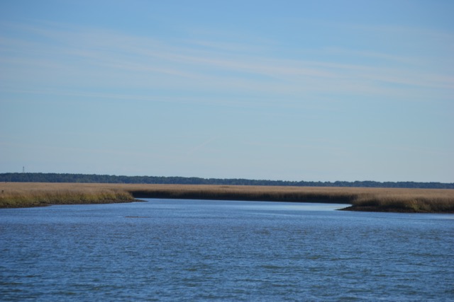
This landing has been my portal to exploring Cape Romain and Bull Island. The outgoing tide and the adjacent entrance to Anderson Creek have provided the access for many adventures on Kingfisher. It is easy to imagine dugouts canoes pulled up on the strand awaiting the assistance from the tide in heading out to Onisecau and Seewee (the bay). Or as many people due today, paddling out to the nearby bountiful oyster banks, and harvesting other seafood.
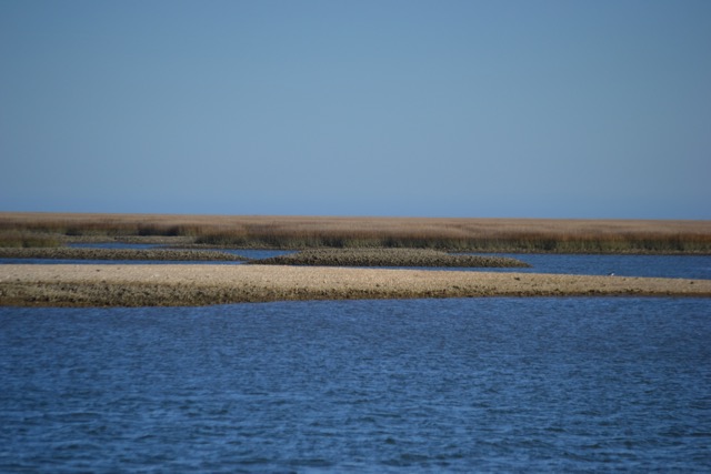
This landing is also a portal to the night sky and the cosmos, and would have been in the past, a place with open views to most areas of the night sky. Celestial events ranging from solar and lunar eclipses to planetary conjunctions have been attractions, and I expect the site’s inhabitants would have taken advantage of the open views to the cosmos.
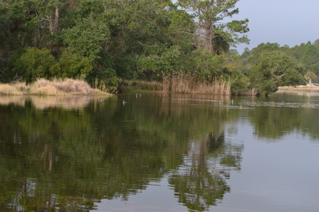
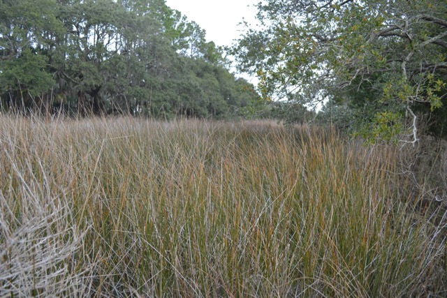
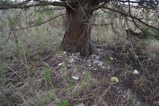
That New Year’s Eve morning, dark clouds to the south advanced and a light rain started. Intending to take some photos, I walked down to the narrow end of the peninsula where the needlerush marsh outlet of the impoundment meets up with the salt marsh. I sought some cover from the rain underneath a small live oak, and noted midden remnants under here and all along the tree and shrub edge of the land, populated by live oak, cedar, palmetto, hackberry, wax myrtle, yaupon holly, sea myrtle, and prickly pear.
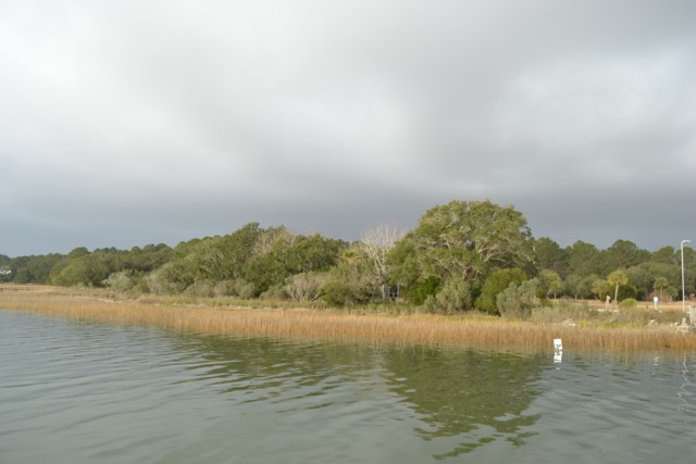
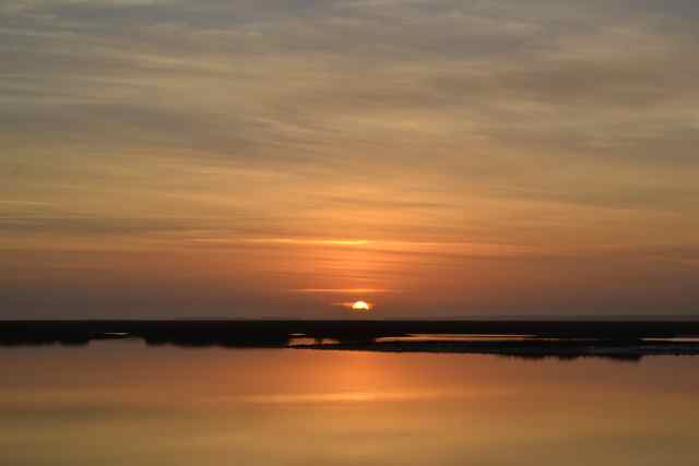
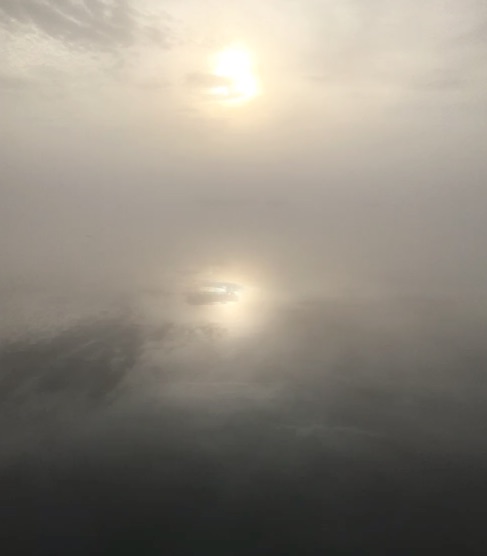
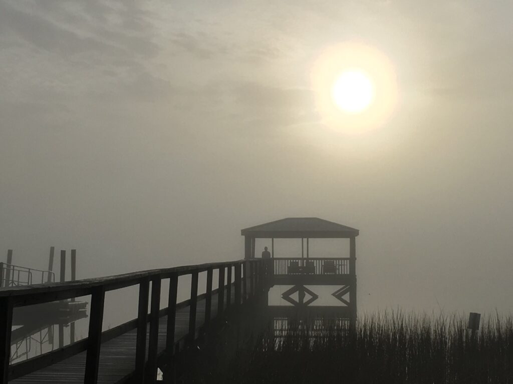
The dawn of New Year’s Day was obscured with a pea-soup fog, reducing the visibility at the landing, and hiding banks on the ICW’s other side. The sun worked hard to burn through the veil of moisture filling the atmosphere. At the end of the dock, I was immersed and mesmerized by the phenomenon. A neighbor captured my fog vigil.
This moment evolved as the fog slowly began to dissipate. An eagle flew off from the mainland and over the marsh toward an invisible and distant island. A mud flat appeared covered with the dark bodies of birds, and as they took flight their whistles identified them as oystercatchers. The unveiling process continued. I was reminded of other routine and extraordinary moments at this place. The ongoing presence of dolphins swimming by, as well as hearing their exhalations on still nights, recently during the saturn and jupiter conjunction. The daily hunt for fish: plunging dives of pelicans and terns in the Waterway, submerging cormorants, ospreys over the impoundment, and black skimmers scything through the shallows. Resident kingfishers, perched on the dock railing and rattling across the water. My embarking on many a passage on Kingfisher. And one incredible moment, when a horseshoe crab seemed to defy reality as it rose out of the water – in the jaws of a loggerhead turtle.
I imagine moments experienced by the indigenous inhabitants. Surely it would have been a place to give thanks, especially for the daily events in the East.
Fascinating and wonderful last photo
Gene Waddell in 1959 I think was still in high school. I went to his papers when I wrote on the Shell Ring as a calendar. He was laughing at the official finding it was a fish trap. A beautious mysterious run of coastland. b
Your father I’m sure was familiar with the Andersonville Mound. It is quite an amazing coast we live on.
It was disturbing to read about the loss and destruction of the shell rings, but Bob’s reflections of a new morning and a new year offered hope and inspiration. Peace my friend.
Yes sad and disturbing. And more profound is the loss of those people.
Peace it is.
Very interesting, Bob. Did the developers not need a permit to destroy the shell mound and relics? Beautiful pics and wonderful article.
It appears that most of the destruction happened in that period between 1930 and 1959.It was not developers but the International Paper Company who removed the material. In those days it seemed that people could do what they wanted with their land and in the name of progress. I assume that other prehistoric sites got the same treatment.
As a former resident of your neighborhood… 🙂 I continue to be impressed and learn from you, about the “neighborhood”. Great stuff!!! g
Our prehistoric neighborhood was I’m sure a vibrant and fascinating place.
Thank you for another amazing post. Bill and I went walking across the street looking for the place where the missing mound had once been. We have walked there many times but now we know how special and sacred this place is. 🙏
It is a challenge to visualize what an impressive site it was.