All elements had marched together toward this Saturday morning. Outgoing tide low at 11, NE wind 10 knots, and the day warming up to sixty degrees. After a week of days not getting much warmer than the low forties, and an absence of sun until Friday, this day boded well. Despite the cold start still below forty, I arrived at the landing sometime after 7, looking to latch on to the elements for a sail out to the island. The sun popped up above a low bank of clouds on the eastern horizon. 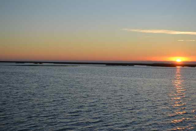 There was a purity to the air, a visual clarity that gave sharp details to the natural world. The atmosphere produced sound of outstanding resonation: the wheep of oystercatchers, the rattle of a kingfisher, the rumble of distant surf on the barrier island.
It was all port tack to the island, close hauled at times through the creeks, but mostly reaching out to Bulls Bay and then across, sitting on Kingfisher‘s port side. The creek was a flyway for oystercatchers, bay ducks, and cormorants. Earlier the sound of an outboard engine had come across the marsh, and a boat appeared out on the Bay. A percussive banging went off intermittently, surely gunning in the distance. There was enough water to cut across the shoal coming out from the marsh on the Bay’s southwest side. I was reassured about the depth on this outgoing tide by a dolphin paralleling my course to leeward near the marsh. The wind continued to freshen as we bore off into Bull Creek to run down to the dock, giving us a further push against the outgoing tide we opposed. The outboard charged off the Bay and followed us into the creek, working his line of crab pots. The crabber had company: a crewman huddled behind the makeshift cabin against the cold, a dog, and over a dozen brown pelicans taking advantage of each bait change. He continued up his line in Bull Creek while I entered Summerhouse Creek for the landing at the dock, the sail over taking less than an hour under these most favorable conditions and fortune.
On the beginning of my walk, I ran into an old associate, Andrew Jackson. That is, his likeness on a twenty dollar bill, lying by the side of the road, damp, but none the worse for the wear. 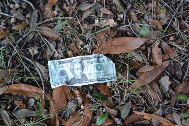 It appeared that the day’s good fortune continued, though I anticipated much more. My hike was both planned and spontaneous, unlike many in the past where a definite loop was on the agenda. A main plan today was getting off the roads and trails to explore the forest, though I had not exactly decided where. My walk across the island on Big Pond Road made clear that the island was covered with more water than I had previously seen. Big Pond lived up to its name, and waterfowl exploded or skidded off in the water-covered forest.
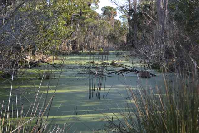
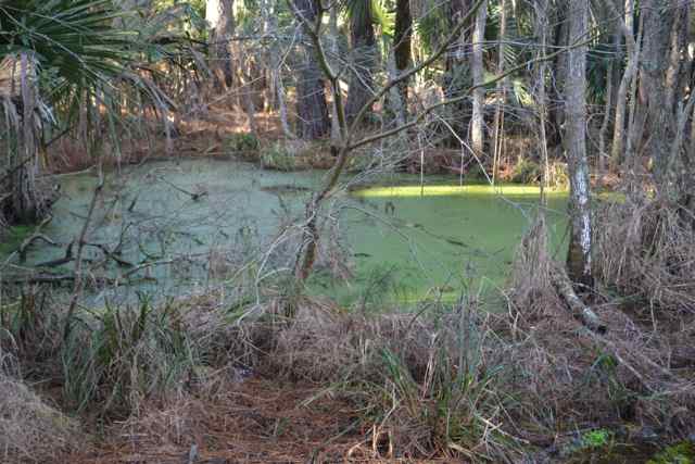
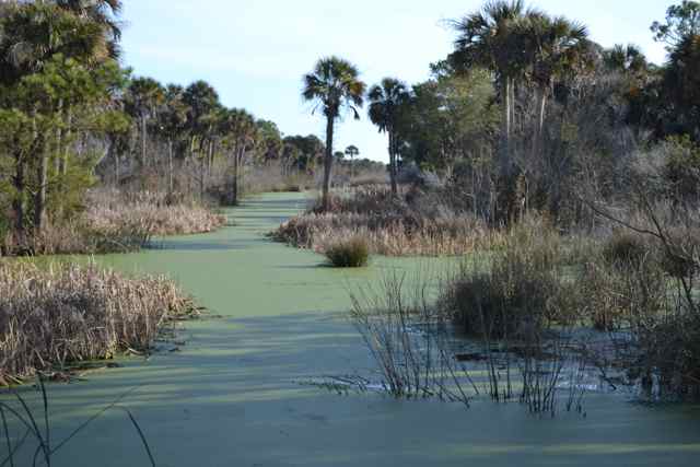
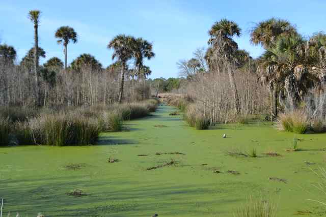
Wetlands reigned, and I realized that any walk off the road and trail system would encounter water. I decided to carry my walk past Lighthouse Road on a trail leading to the ocean, despite the backtrack (first of a number that day). This trail has always been a favorite of mine: impressive transitions in ecosystems in a short walk, elevation changes created by forested high sand hills residual from old sand dunes, and the access to the beach and ocean off the beaten path.

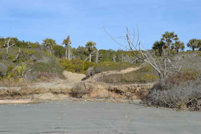
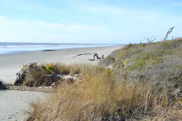 Once again, this walk provided all that and more.
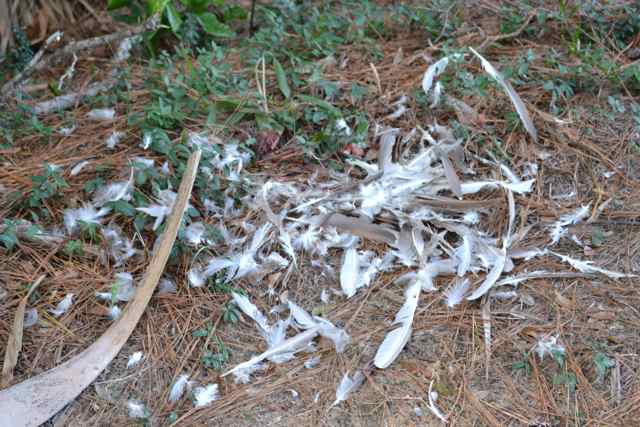
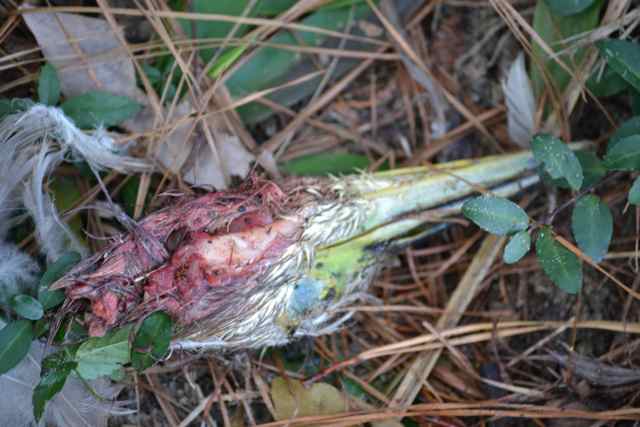
After the backtrack, I pushed on to Alligator Alley, and to a familiar pool off of Jacks Creek. An array of wading birds and migratory waterfowl were present, though the waterfowl and anhingas were skittish and took off while the wading birds hung around. 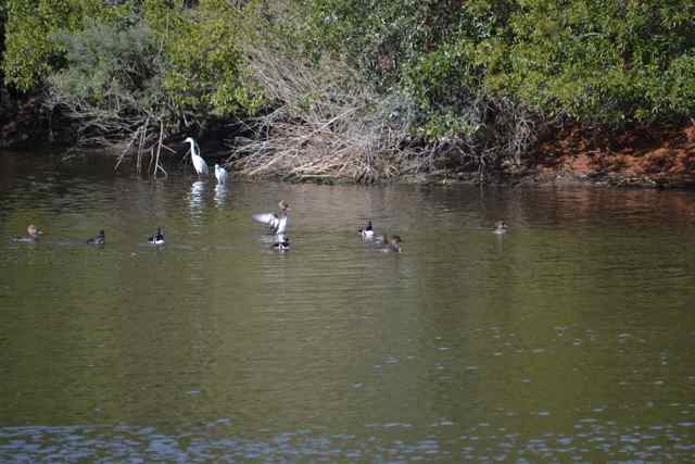 Backtracking (again) to Alligator Alley, I hoped I was timing it right for seeing basking alligators before the ferry passengers’ appearance. Prior to pool #3, a pretty fresh kill sat right next to the road: a circle of feathers, and a bloody skull (identified with help later from Coastal Expeditions captains – immature black-crowned night heron, most likely a bobcat kill).
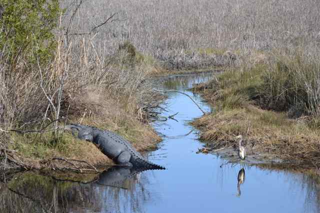
 Right beyond was the first basking alligator, partnered with a Louisiana heron.
 Back along the road, I disturbed a great blue heron high in a tree, and in taking flight sounded its deep croak. I recalled a long ago bushwhack across a forgotten section of the island, and running into a great blue heron rookery and a chorus of squawks.
Prior to the turn in the road, I walked out along the alligator crawl to this next section of Jacks Creek. As everywhere seen, the waters were fully populated with an array of birds, notably hooded mergansers. 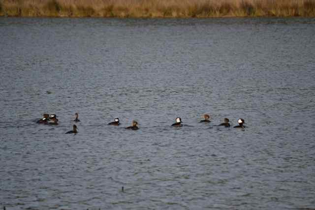 Coming around to pool #2, always the most populated with alligators, I crossed paths with the two first ferry passengers. I learned the dike was not yet covered with basking gators, but several were along the far end. Despite another necessary backtrack, I had earlier decided to walk the path to the observation tower over Jacks Creek.
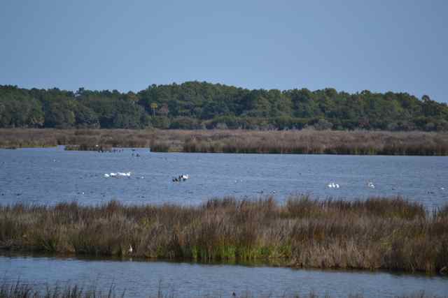
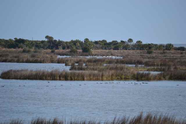
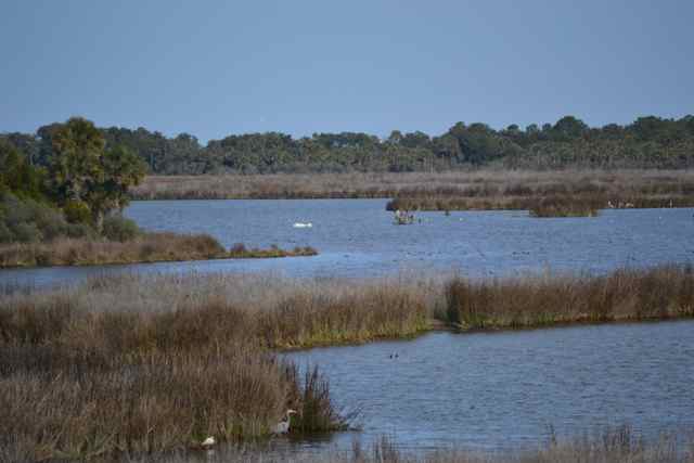
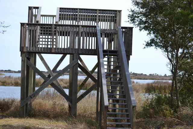 Ascending the tower, I came upon a view I had not previously seen of the impoundment fulfilling its avian potential: hundreds and hundreds of birds. It was hard to know where to start in looking closer, but the large groups of white pelicans were most prominent. I made no effort to count but the panoramic view from the tower perhaps displayed dozens of the white majestic birds. Large groups of ducks congregated in rafts, and wading birds abounded. Some took to the air, and flew by the tower for a more close-up sight, while the divers regularly ducked beneath the surface. I set up shop on this roost, pulling out lunch, taking notes, capturing photos, and looking closer with the viewing binoculars, including into the distance. The two lighthouses on the other side of the Bay resolved easily to the ENE. The birds were the main attraction, finding food and habitat on these federal lands, existing exactly for this purpose.
 On the backtrack, I ran into the Coastal Expeditions captains, three today since they used skiffs for the ferry ride.
 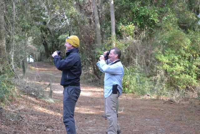 Chris, Will, and Gates were heading to the observation tower, and had stopped to look at birds in the finger of Jacks Creek to the northwest where I earlier stopped for my first white pelican photos of the day.
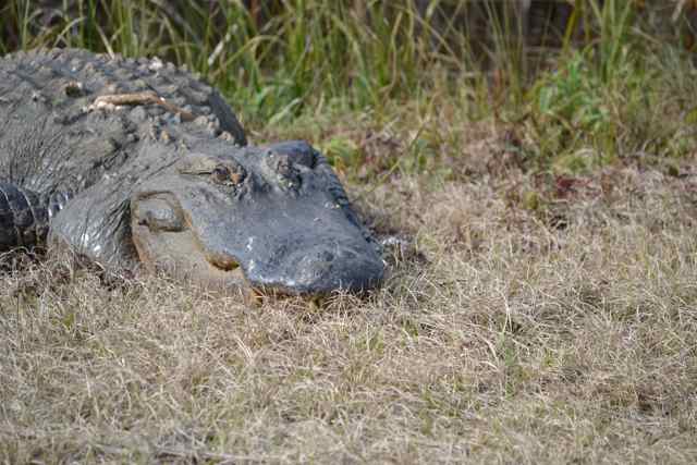
 Will had been involved in doing recent bird counts with David McLean on the island, and later shared the results. A survey from a few days before had large numbers of migratory waterfowl, including gadwall (720), American coot (1064), hooded merganser (218), ruddy ducks (289), northern shovelers (156), and lesser scaup (282). The captains were clearly excited by all the bird action, and they headed to the tower as I continued my walk. By pool #1 a gator was stretched out on the side of the dike, and another was closer to the water on the opposite side. No movement was discerned as I passed by.
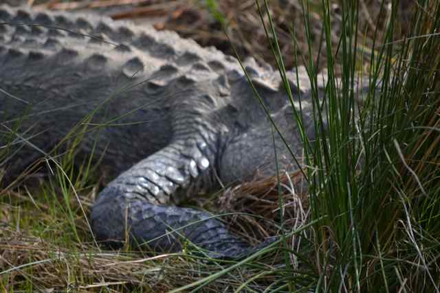
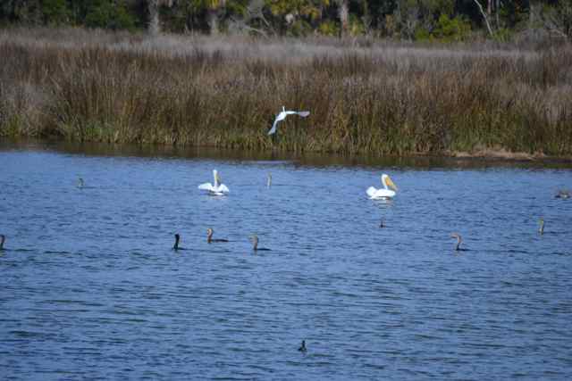
Just past the gators a group of white pelicans fished in this northwest finger of Jacks Creek in consort with cormorants. 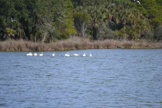 It appeared they were working together in a familiar way, these two species in the order Pelecaniformes.
Indecisive on the Old Fort Road, I finally turned around to provide time for a last walk, my bushwhack. My motivation for this off trail adventure stemmed from the deep freeze of the previous week, surely knocking down the tick population. Time had flown, and I wished to not leave the island too late. Letting go of a more ambitious cross country path, one surely to be impeded by wetlands, I opted for the last dead end road across from Big Pond Road, planning to pass through the dead end and connect with the Midden Trail.
The walk was through forest dense and tangled, and soon wet: it was the subtropical jungle of the Bull Island maritime forest.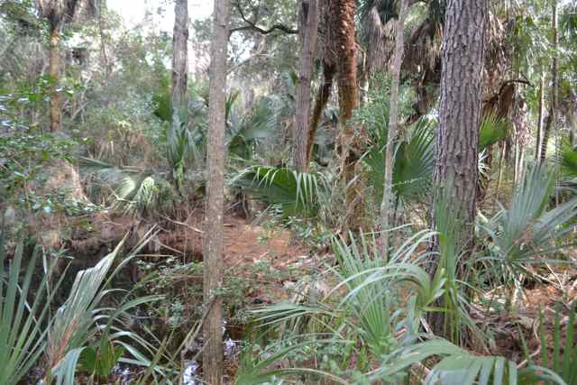
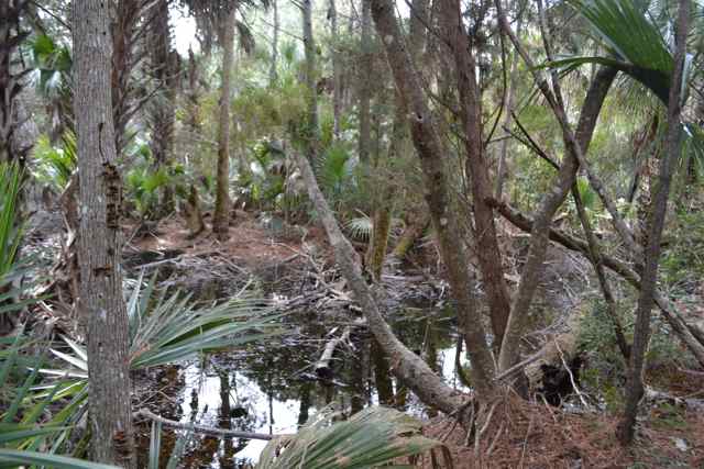 I picked my way around the water as best I could, until I encountered a slough stretching out to both flanks. I chose a log for the first crossing. Two decisions proved faulty: the palmetto log under my feet crumpled under my shoe, and the dead branch I used for support with my right hand broke off and came down at the same time. Fortunately I had grabbed just minutes before a fine bamboo cane to carry along for support, and it helped in this precarious spot to shift to another foot log. Still, my left foot went into the water, and my low waterproof shoes don’t shed water at ankle depth. Deja vu all over again – a cold morning last winter stepping off a dune to the sand and finding instead a sea foam-covered deep puddle. Same foot, same shoe, just not so cold, but a reminder of the value of wool socks. Safely across, it appeared that only one more slough separated me from the Midden Trail, since high ground appeared on the other side.
 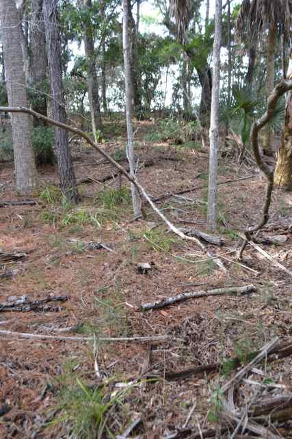 Choosing carefully this time, I opted to avoid a palmetto log crumpling beneath the bamboo cane, and utilized an oak tangle to climb/tightwalk to the other side.
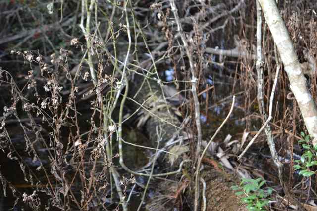
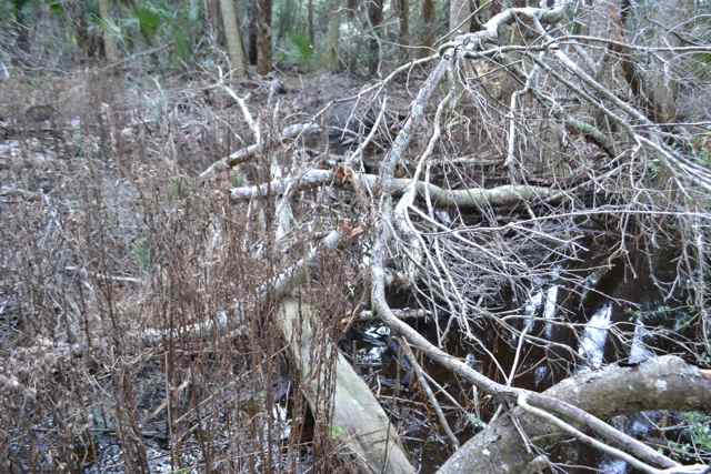 Up the embankment, and back on the Midden Trail, I covered the short distance to the dock, left the bamboo for another walker, and prepared for the sail home.
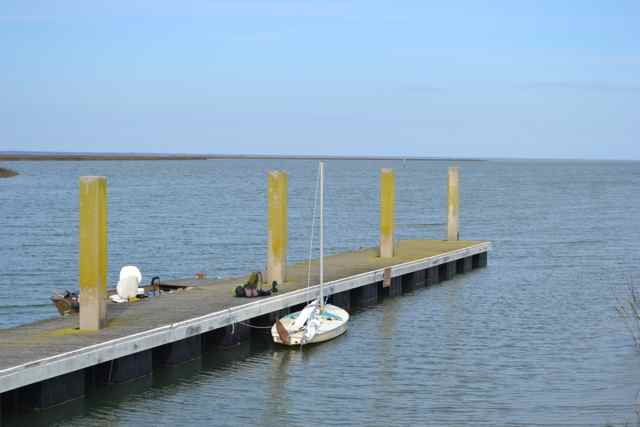
Suited and rigged up, we began some close hauled work into Bull Creek prior to the turn for the ferry passage. In this creek the incoming tide gave an assist in the moderate breeze. I was passed in this section by Captain Chris in his passenger-laden skiff, and he slowed to take a photo of Kingfisher in decent trim. 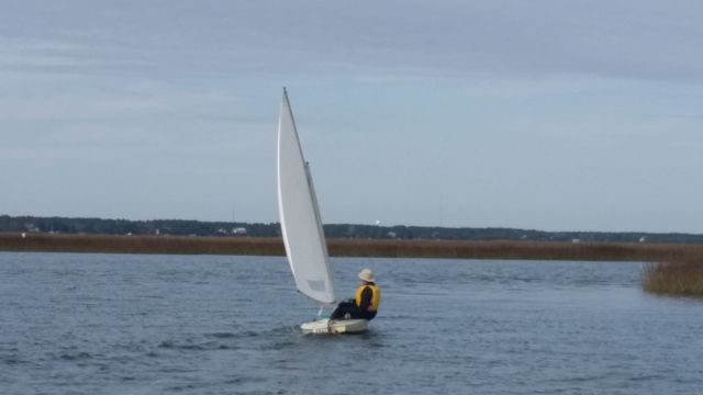
Photo credit: Chris Crolley
I pointed to the sun, and he noted the ring. “A ring around the sun or moon, means rain or snow coming soon” is the old adage, and the rain did come later that night. We left the ferry passage to continue against the wind and tide in this section of Andersonville Creek until we were able to ease and reach with the tide toward home. Distant surf and the call of a loon sounded in departing the creek for the Waterway and the sail’s end, and I appreciated fortune’s smile.
Nice Post Bob, It was good to see you again, and fitting that it would happen on the island. I’m looking forward to seeing you out there again soon!
Likewise, and keep up the good work with the bird surveys. Lots to count out there, captain!
Great post, Bob. It’s so nice to read of your explorations… It makes these dark days in the library so much more tolerable.
Winter is a great time for exploring out there, though spring, summer, and fall are excellent too. But bug free and cool hiking weather is always fine.
Nice blog! I just found this today looking for info on the area. I have a February trip planned that has me camping at Buck Hall Rec. Area for a few days and sailing off the ramp in a small boat (though not quite as small as yours), exploring the area. I will add Bull’s Island to the list of places to check out. I welcome any other tips and will read more of your blog with interest.
Matt
Buck Hall is a good place, though access for a sailboat to more open water is a bit challenging. I’m not sure where you are coming from, and what draft you boat has, but at least the Intracoastal Waterway will provide you with some sailing waters, though I prefer to get out of the “Ditch” due to traffic. The Sewee Center on Hwy 17 is a good place for you to go for more info about the area – both Cape Romain and Francis Marion Nat’l Forest.
Yes, I realize the “ditch” is not ideal but it looks like there is access to Bull’s Bay a couple miles north. Are you aware of a campground in the area with better access to more open water? I am coming from VA and my boat (Core Sound 17) has shallow draft.
You are right – Five Fathoms Creek to the north is the best way to access the Bay. By the way, my second book, Tracing the Cape Romain Archipelago, covers this area on many different sailing expeditions with a map for each. Looks like the Core Sound 17 can be a handy craft for these waters. Happy sailing!
Thanks for the tip! I picked up your book and am about halfway through it. Lots of good info there.
I’m looking forward to exploring the area. Right now, the forecast is pretty cool but I realize a lot can change in a week and a half.
Wow, another great day on Bull Island! How long do you expect all those birds to hang around?
I am planning on them staying until later in February so they will be around for the hike I am leading on Feb. 21. The white pelicans are definitely enjoying the refuge, since we are seeing them all year round now.